摘要:
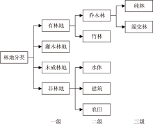
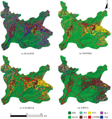
基于Landsat 8 OLI遥感影像和森林资源二类调查数据,对有林地、灌木林地、未成林地和非林地等林地类型,分别采用最大似然、神经网络、支持向量机和决策树分类方法进行分类,验证分类精度,并对分类效果进行对比评价。结果表明:支持向量机分类方法表现最好,分类精度为78.7%,Kappa系数为0.76;其次为神经网络和决策树分类方法,分类精度分别为76.8%和72.5%,Kappa系数分别为0.72和0.68;最大似然法表现最差,分类精度为44.9%,Kappa系数为0.39。研究结果可为森林资源信息的快速提取提供理论依据。
中图分类号:
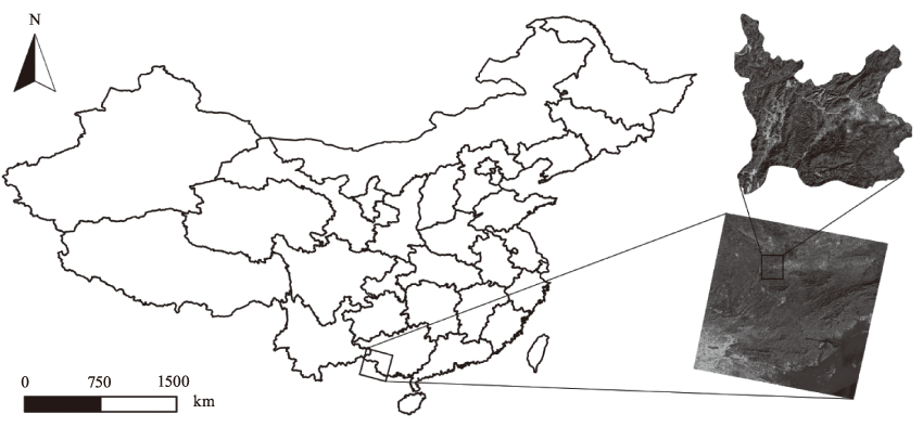
张乃静, 侯瑞霞, 纪平. 基于遥感影像和二类调查数据的林地类型分类方法对比研究——以广西凭祥市为例[J]. 林业资源管理, 2017, 0(4): 89-96.
ZHANG Naijing, HOU Ruixia, JI Ping. Study on Classification Methods Based on Remote Sensing Image and Forest Resources Management Survey Data—Take Pingxiang,Guangxi Autonamous Region as an Example[J]. FOREST RESOURCES WANAGEMENT, 2017, 0(4): 89-96.
 ), 侯瑞霞, 纪平(