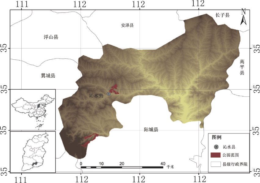
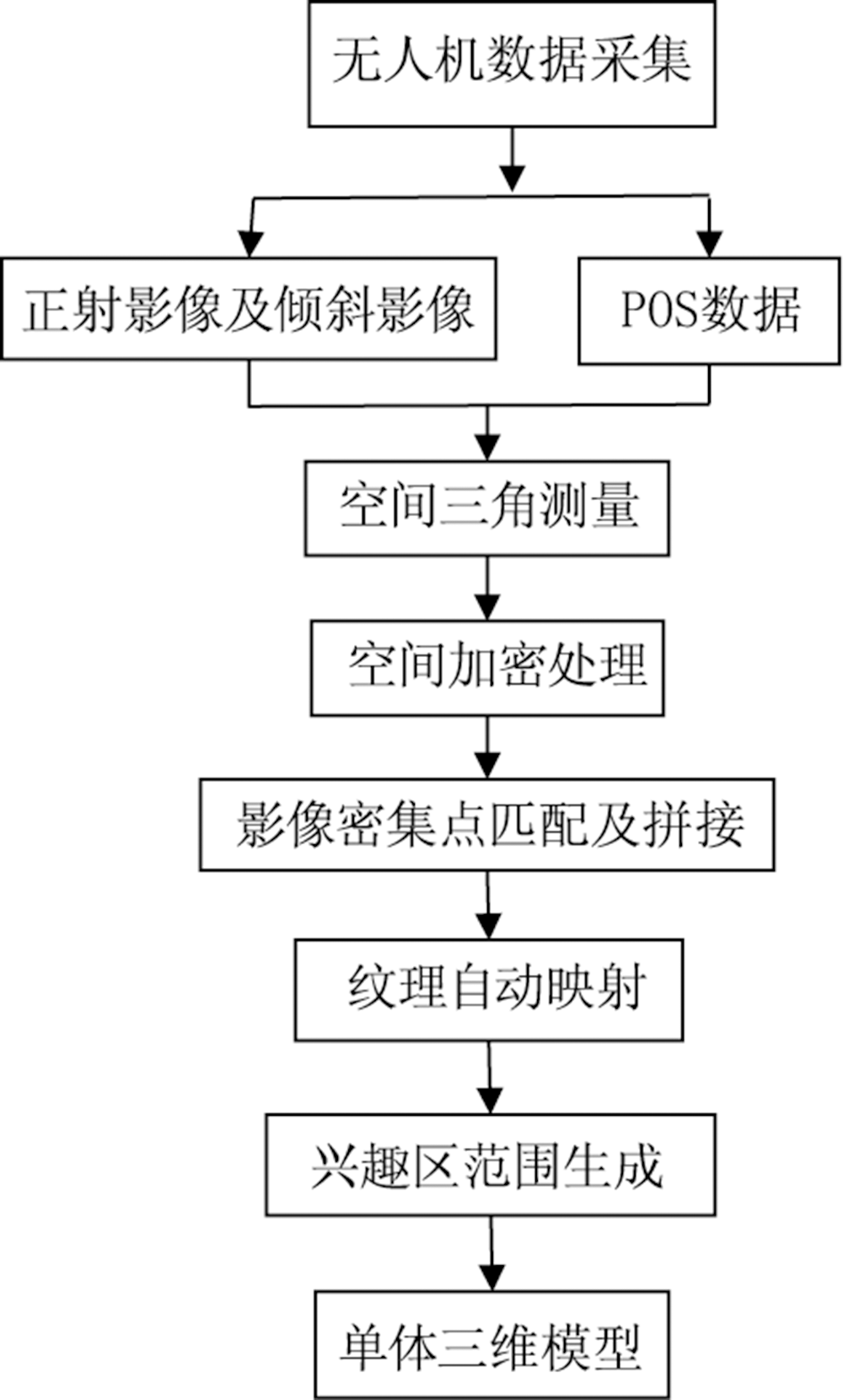
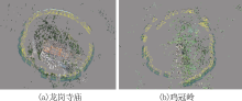
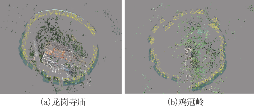
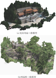
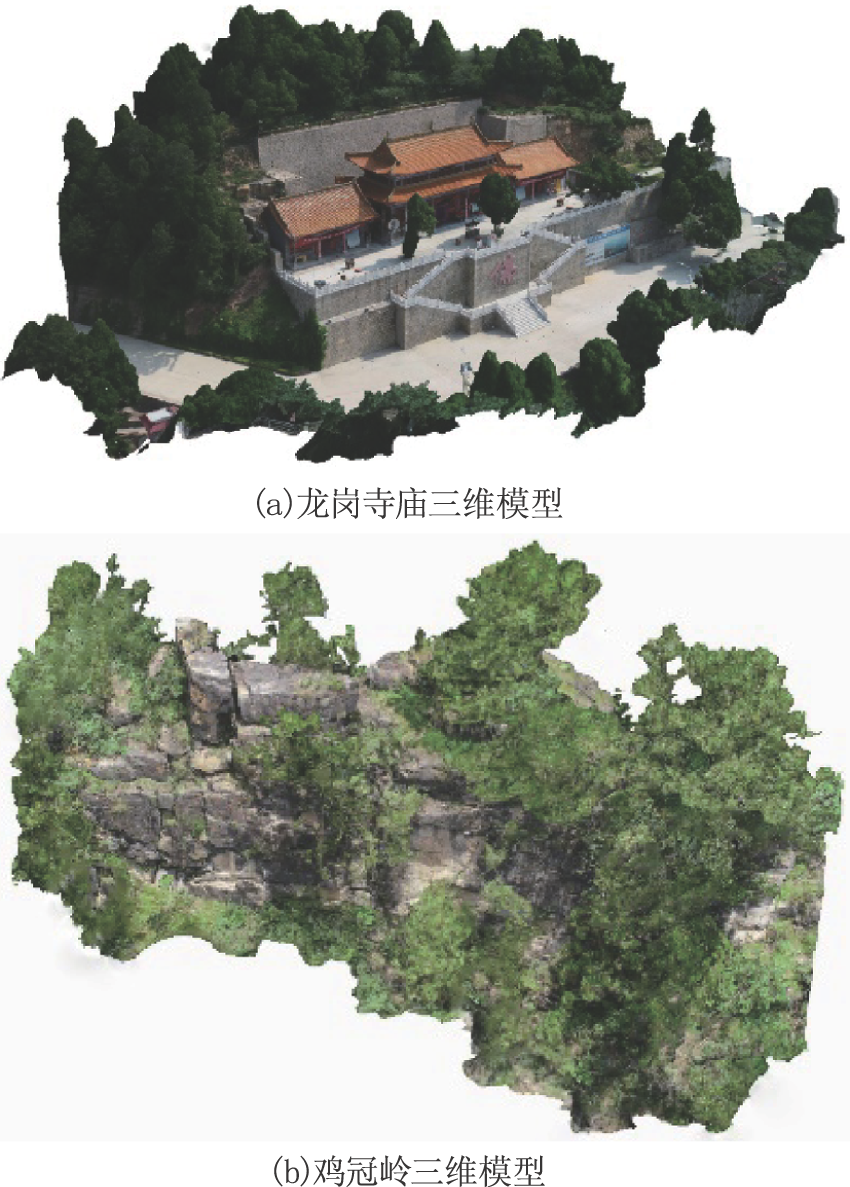
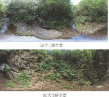
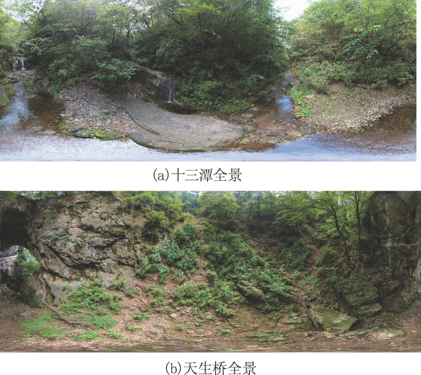
| [1] |
屈中正, 张艳红. 论国家森林公园的设置、特征及文化教育功能[J]. 湖南林业科技, 2011,38(2):62-64.
|
| [2] |
李梓雯, 张俊玲. 论国家森林公园生态文化建设[J]. 低温建筑技术, 2011,33(2):33-34.
|
| [3] |
佚名. 国家林业局关于修改部分部门规章的决定[J].中华人民共和国国务院公报, 2016(6):53-54.
|
| [4] |
佚名. 森林公园管理办法[J].中华人民共和国国务院公报, 2017(28):66-67.
|
| [5] |
曾文波, 曾惠良. 无人机在邵阳市房产测绘中的应用[J].测绘, 2014(1):34-36.
|
| [6] |
梁伟, 刘长宁, 吕林涛 等. 无人机倾斜摄影测量技术在旅游开发中的应用[J].宁夏工程技术, 2018(2).
|
| [7] |
赵星涛, 胡奎, 卢晓攀 等. 无人机低空航摄的矿山地质灾害精细探测方法[J]. 测绘科学, 2014,39(6):49-52.
|
| [8] |
刘洋, 祁琼. 无人机航摄技术在国土资源领域的应用[J].地理空间信息, 2014(1):29-30.
|
| [9] |
李军, 李永树, 蔡国林. 利用无人机影像制作地震灾区三维景观图[J]. 测绘工程, 2012,21(1):50-53.
|
| [10] |
冯家莉, 刘凯, 朱远辉 等. 无人机遥感在红树林资源调查中的应用[J]. 热带地理, 2015,35(1):35-42.
|
| [11] |
杨国东, 王民水. 倾斜摄影测量技术应用及展望[J]. 测绘与空间地理信息, 2016,39(1):13-15.
|
| [12] |
李安福, 曾政祥, 吴晓明. 浅析国内倾斜摄影技术的发展[J].测绘与空间地理信息, 2014(9):57-59.
|
| [13] |
彭培胜, 王懿祥, 吴建强 等. 基于无人机遥感影像的三维森林景观可视化[J].东北林业大学学报, 2013(6):61-65.
|
| [14] |
何敬, 李永树, 鲁恒 等. 无人机影像的质量评定及几何处理研究[J].测绘通报, 2010(4):22-24.
|
| [15] |
李德仁, 肖雄武, 郭丙轩 等. 倾斜影像自动空三及其在城市真三维模型重建中的应用[J]. 武汉大学学报:信息科学版, 2016,41(6):711-721.
|
| [16] |
邹晓亮, 缪剑, 张永生 等. 基于像素工厂的无人机影像空三优化技术[J]. 测绘科学技术学报, 2012,29(5):362-367.
|
| [17] |
方诗明, 姬海莉. 航测内业空中三角测量技术的应用[J].铁道工程学报, 2006(z1):101-106.
|
| [18] |
龚琪慧, 吴健平, 王洁华 等. 基于全景图的3维实景制作及其与GIS集成研究[J].测绘与空间地理信息, 2012(6):33-37.
|
| [19] |
丁雄. 球面全景图技术研究[D]. 长沙:国防科学技术大学, 2002.
|
| [20] |
周智勇, 丁玉兰. 基于多旋翼无人机的空中全景地图制作研究[J].城市勘测, 2016(2):101-104.
|
| [21] |
李德仁, 李明. 无人机遥感系统的研究进展与应用前景[J]. 武汉大学学报:信息科学版, 2014,39(5):505-513.
|
| [22] |
曲林, 冯洋, 支玲美 等. 基于无人机倾斜摄影数据的实景三维建模研究[J].测绘与空间地理信息, 2015(3):38-39.
|
| [23] |
余忠迪, 李辉, 巴芳 等. 基于消费者级无人机的城市三维建模[J]. 国土资源遥感, 2018,30(2):67-72.
|
| [24] |
丁志广, 严新生, 陈辉光. 无人机倾斜摄影用于江门市快速三维建模的探讨[J].城市勘测, 2016(4):72-78.
|
 ), 龙晓敏2, 邓忠坚3, 叶江霞1(