欢迎访问林业资源管理

林业资源管理 ›› 2021, Vol. 0 ›› Issue (4): 138-148.doi: 10.13466/j.cnki.lyzygl.2021.04.018

• 技术应用 • 上一篇    下一篇

陆地生态系统碳监测卫星多载荷替代数据海南综合试验

刘迎春(), 吴发云, 孙忠秋, 付安民, 高金萍, 高显连(), 高剑新, 崔晨彦, 晁智   

  1. 国家林业和草原局调查规划设计院,北京 100714
  • 收稿日期:2021-07-17 修回日期:2021-07-27 出版日期:2021-08-28 发布日期:2021-09-26
  • 通讯作者: 高显连
  • 作者简介:刘迎春(1984-),男,山东枣庄人,高工,博士,主要从事激光雷达林业产品开发和应用、森林碳估算研究。Email: liuyingchun2005@163.com
  • 基金资助:
    国家自然科学基金项目(31400426);国家林业和草原局行业管理专项(2130237);国家林业和草原局碳卫星海南试验站设备采购及集成项目(169104000000180023);林业资源监测机载系统建设项目(169104000000180025)

Comprehensive Experiment Substitute for Multi-Payload Data of Terrestrial Ecosystem Carbon Inventory Satellite in Hainan

LIU Yingchun(), WU Fayun, SUN Zhongqiu, FU Anmin, GAO Jinping, GAO Xianlian(), GAO Jianxin, CUI Chenyan, CHAO Zhi   

  1. Academy of Inventory and Planning,National Forestry and Grassland Administration,Beijing 100714,China
  • Received:2021-07-17 Revised:2021-07-27 Online:2021-08-28 Published:2021-09-26
  • Contact: GAO Xianlian

摘要:

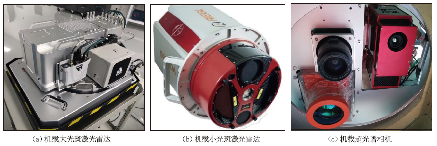
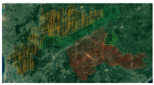
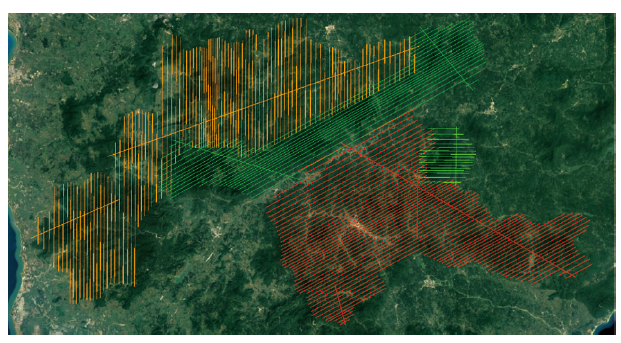
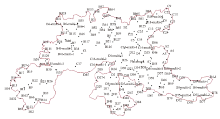
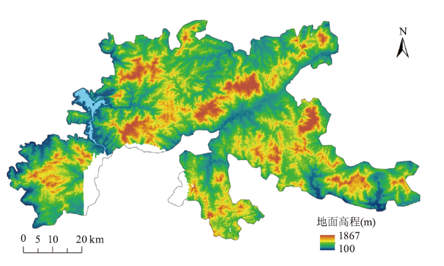
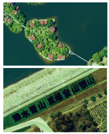
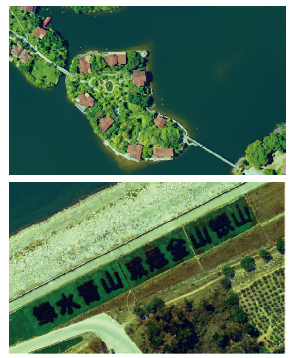
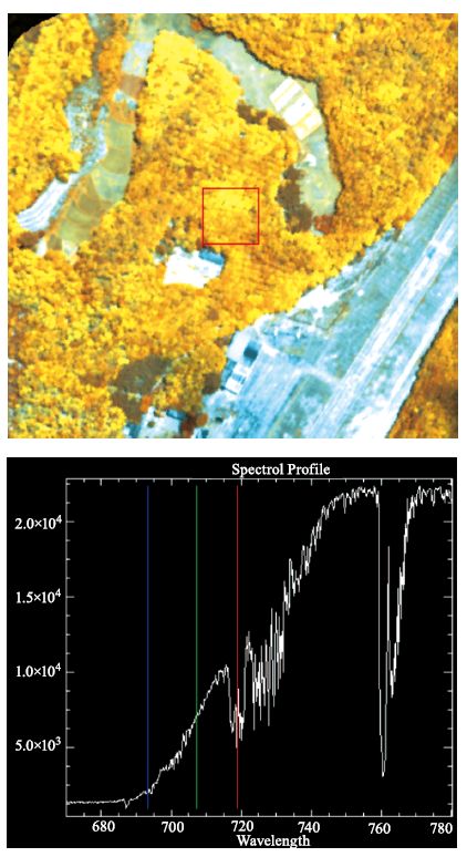
海南保存着我国仅有的几处热带雨林之一。系统获取热带雨林天空地数据,是热带雨林国家公园管理的前提,也是在全国建立陆地生态系统碳监测卫星主要森林类型产品生产方法的重要组成部分。2020年3月20日至2021年7月10日,借助全国林草资源调查机载平台获取并生产超过6 000km2,20TB航空大光斑激光雷达、小光斑激光雷达、可见光和近红外影像、超光谱影像原始数据和产品,完成170个森林调查样地、183个控制点和17个检查面。这些数据与高分七号、GEDI数据一起,构成了覆盖海南热带雨林国家公园及周边区域的天空地数据。产品精度显示,大光斑激光雷达平面和高程精度分别优于1m和0.15m;小光斑激光雷达平面和高程精度分别优于0.5m和0.08m;数字地形模型(DEM)高程精度和冠层高度模型(CHM)高度精度分别达到0.15m和91.8%;0.2m数字正射影像(DOM)平面精度优于0.5m;超光谱影像的光谱分辨率0.24nm,空间分辨率1~2m。通过试验,以期为陆地生态系统碳监测卫星林业产品开发和海南热带雨林国家公园管理提供高质量天空地数据。

关键词: 全国林草资源调查机载平台, 机载大光斑激光雷达, 机载小光斑激光雷达, 机载超光谱相机, 数字地形模型(DEM), 冠层高度模型(CHM), 数字正射影像(DOM), 陆地生态系统碳监测卫星

Abstract:

Hainan conserves one of the last tropical rainforests in China. The space-air-ground comprehensive data in tropical forest is not only the basis of the management of National Park of Hainan Tropical Rainforest,but also an important component to set up methodology of Terrestrial Ecosystem Carbon Inventory Satellite (TECISat) in China. From March 20,2020 to July 10,2021,we used National Forest and Grassland Inventory (NFGI) airborne platform to produce 20TB raw data and products that covered an area more than 6000 km2,including airborne large-footprint LiDAR,small-footprint LiDAR,visible and near-infrared image,and ultra-spectrum image. We also collected data from 170 forest plots,183 ground control points and 17 checking polygons. Combined with GF-7 and GEDI data,these data constituted the space-air-ground data covering National Park of Hainan Tropical Rainforest and surrounding area. The products showed that the horizontal and elevation accuracy of large-footprint LiDAR were better than 1m and 0.15m respectively. The horizontal and elevation accuracy of small-footprint LiDAR were better than 0.5m and 0.08m respectively. The elevation accuracy of DEM and height precision of CHM were 0.15m and 91.8% respectively. The horizontal accuracy of 0.2m DOM was better than 0.5m. The spectral and spatial resolution of ultra-spectrum image were 0.24nm and 1~2m respectively. This experiment provided high quality products and space-air-ground data for TECISat and national park management.

Key words: National Forest and Grassland Inventory (NFGI) airborne platform, NFGI airborne Large-footprint LiDAR (NFGI-LIDAR-L), NFGI Small-footprint LiDAR (NFGI-LIDAR-S), NFGI airborne Ultra-spectrum camera (NFGI-SPECTRUM-U), Digital Elevation Model (DEM), Canopy Height Model (CHM), Digital Orthophoto Map (DOM), Terrestrial Ecosystem Carbon Inventory Satellite

中图分类号: