欢迎访问林业资源管理

林业资源管理 ›› 2020, Vol. 0 ›› Issue (5): 131-137.doi: 10.13466/j.cnki.lyzygl.2020.05.019

• 技术应用 • 上一篇    下一篇

基于开源GIS的森林资源监测智慧云平台构建

兰玉芳(), 石小华, 李宏韬, 马胜利, 张敏中   

  1. 国家林业和草原局西北调查规划设计院,西安 710048
  • 收稿日期:2020-07-23 修回日期:2020-09-19 出版日期:2020-10-28 发布日期:2020-11-30
  • 作者简介:兰玉芳(1987-),女,陕西神木人,工程师,主要从事“3S”技术在林业调查规划设计和森林资源监测中的应用。Email: 715489923@qq.com
  • 基金资助:
    国家林业和草原局西北调查规划设计院科技创新实验项目“森林督查云平台建设”(2019005);国家林业和草原局西北调查规划设计院科技创新实验项目“面向对象技术驱动的林地变化遥感监测研究与功能实现”(2019010)

Construction of Smart Cloud Platform for Forest Resources Monitoring based on Open Source GIS

LAN Yufang(), SHI Xiaohua, LI Hongtao, MA Shengli, ZHANG Minzhong   

  1. Northwest Surveying,Planning and Designing Institute of National Forestry and Grassland Administration,Xi'an 710048,China
  • Received:2020-07-23 Revised:2020-09-19 Online:2020-10-28 Published:2020-11-30

摘要:

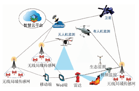
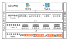
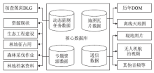
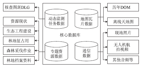
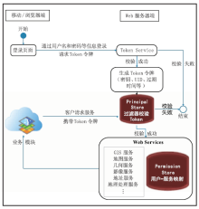
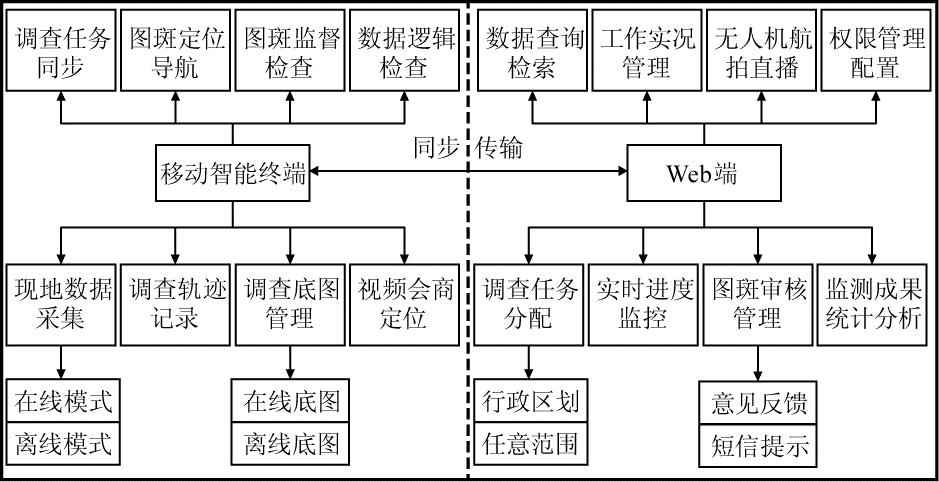
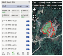
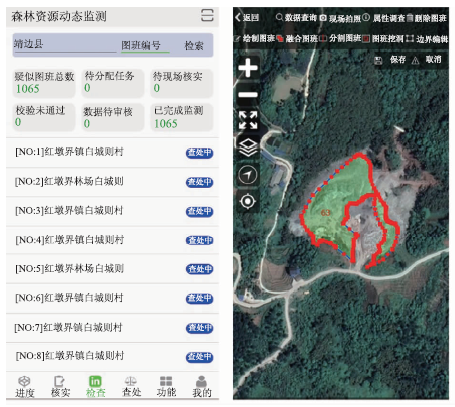
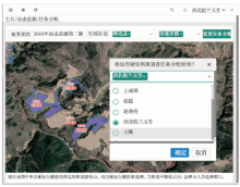
引入“天空地”一体化监测技术体系,选择OpenLayers为客户端、GeoServer为地图服务器、MySQL为空间数据库的开源GIS平台构建WebGIS体系结构,基于Android平台设计开源移动GIS解决方案,同时结合“互联网+”和云计算技术,成功开发与部署了森林资源监测智慧云平台,并对相关技术和平台设计思路进行探讨。通过建设,成功实现了森林资源监测工作的全过程信息化。实际应用表明,该平台很好地实现了森林资源高效快速的数据更新、规范化的工作流程和可视化的监督管理,为改进森林资源动态监测工作工序提供了一种科学可行的思路,是森林资源监测、核查与管理工作的有效探索。

关键词: 开源GIS, 森林资源动态监测, 智慧云平台, “天空地”一体化监测

Abstract:

A smart forest resources monitoring and management platform has been successfully developed through introducing the sky-ground integrated monitoring technology system and an open source GIS platform which adopts OpenLayers as client,GeoServer as map server and MySQL as spatial database to build the WebGIS system. The platform designs the open source mobile GIS solution based on the Android system and combines the“Internet+” and cloud computing technology. The paper attempts to discuss the specific technology and design.The establishment of the platform has helped realize the informationization of forest resources monitoring and it is a good implementation of data update in an efficient and rapid way. It is also helpful in workflow,visualizing management for forest resources monitoring.Meanwhile,the design and development of the platform provides a scientific and feasible way to improve the monitoring process and an effective exploration for dynamic monitoring and management of forest resources.

Key words: open source GIS, dynamic monitoring on forest resources, smart cloud platform, sky-ground integrated monitoring

中图分类号: