FOREST RESOURCES WANAGEMENT ›› 2020, Vol. 0 ›› Issue (2): 161-166.doi: 10.13466/j.cnki.lyzygl.2020.02.024
• Technical Application • Previous Articles Next Articles
SUN Haining(), SUN Yanli
Received:
Revised:
Online:
Published:
Abstract:
According to the need of ancient or rare trees resource management in Beijing,this paper takes the development and application of ancient or rare trees management information system in Beijing as the main content,and completes the management information system of ancient or rare trees in Beijing based on Web.Through the key technologies of statistical analysis and network map,the system meets the needs of the development of information management of ancient or rare trees in Beijing,and realizes the information and fine management of ancient or rare trees in Beijing,it lays a foundation for better protecting ancient or rare trees resources and inheriting the history and culture of ancient or rare trees in Beijing.At the same time,the platform has realized the collection and mining of data related to ancient or rare trees,and is convenient for more scientific and systematic research on ancient or rare trees,it is of great significance to give full play to the important role of ancient or rare trees in the protection of historical and cultural cities and to promote the construction of ecological civilization in Beijing.
Key words: ancient or rare trees, management information system, system development, system application, GIS
CLC Number:
TP391
SUN Haining, SUN Yanli. The Development and Application of a Management Information System for Ancient or Rare Trees in Beijing[J]. FOREST RESOURCES WANAGEMENT, 2020, 0(2): 161-166.
0 / / Recommend
Add to citation manager EndNote|Ris|BibTeX
URL: http://www.lyzygl.com.cn/EN/10.13466/j.cnki.lyzygl.2020.02.024
http://www.lyzygl.com.cn/EN/Y2020/V0/I2/161
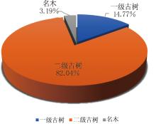
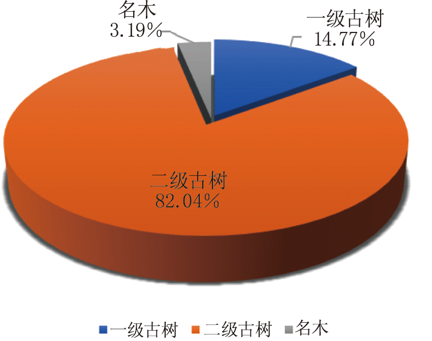
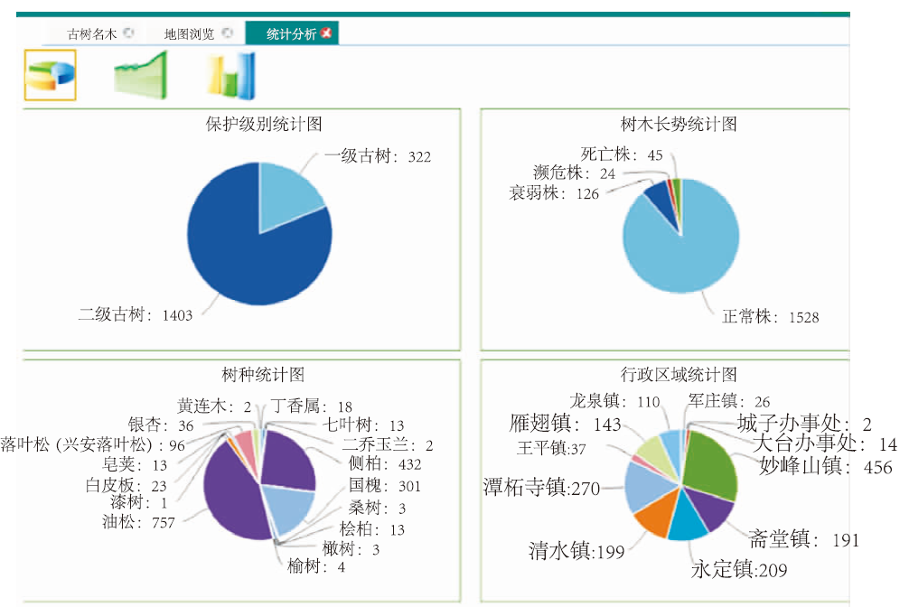
Tab.1
Statistical table of ancient or rare trees in Beijing by quantity and grade
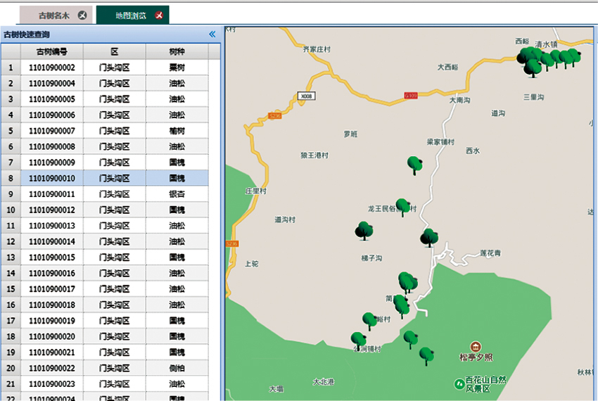
Fig.1
Classification map of ancient or rare trees in Beijing
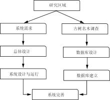
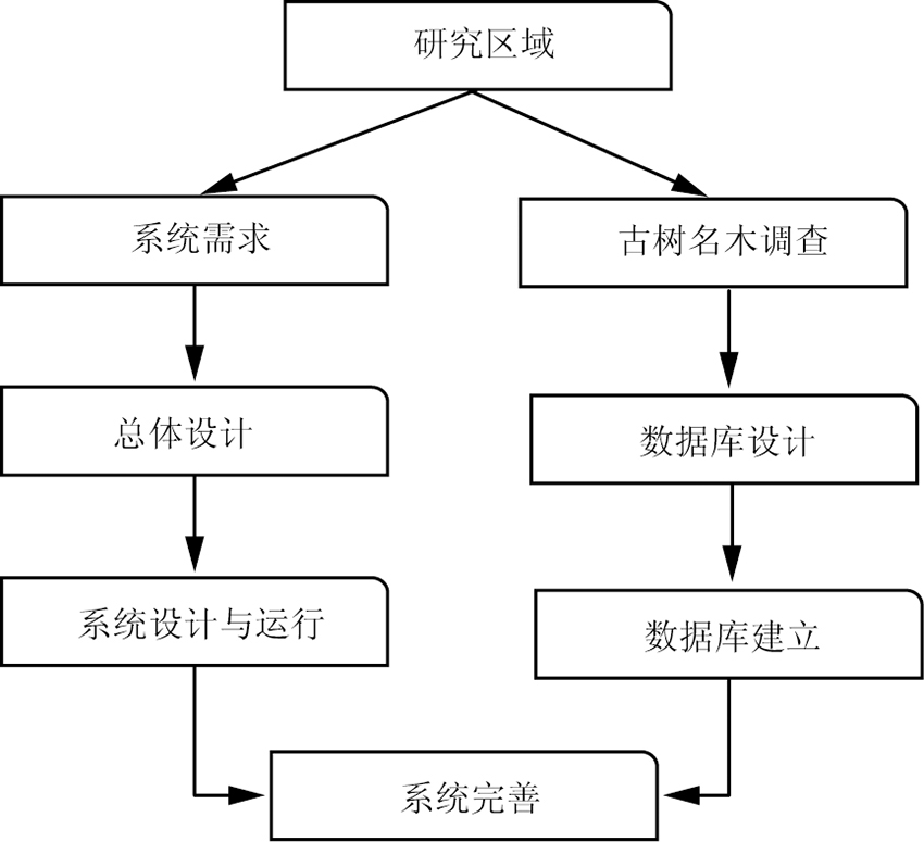
Fig.2
Technical Roadmap
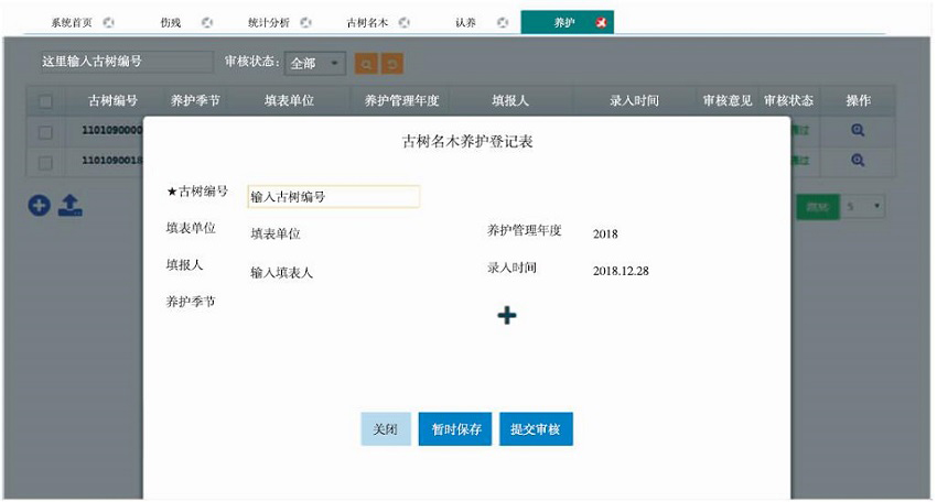
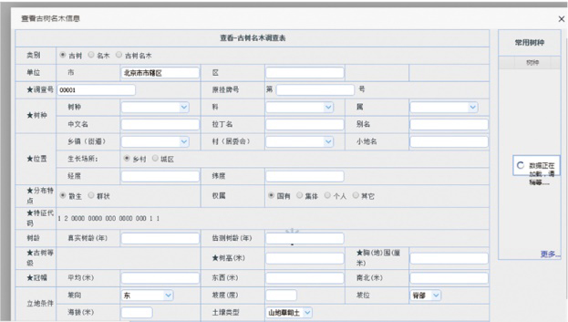
Fig.3
Maintenance management subsystem
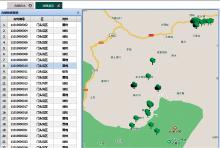
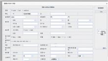
Fig.4
Spatial query subsystem
Fig.5
Thematic mapping and output subsystem
Fig.6
Statistical report and output subsystem
 ), SUN Yanli