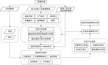
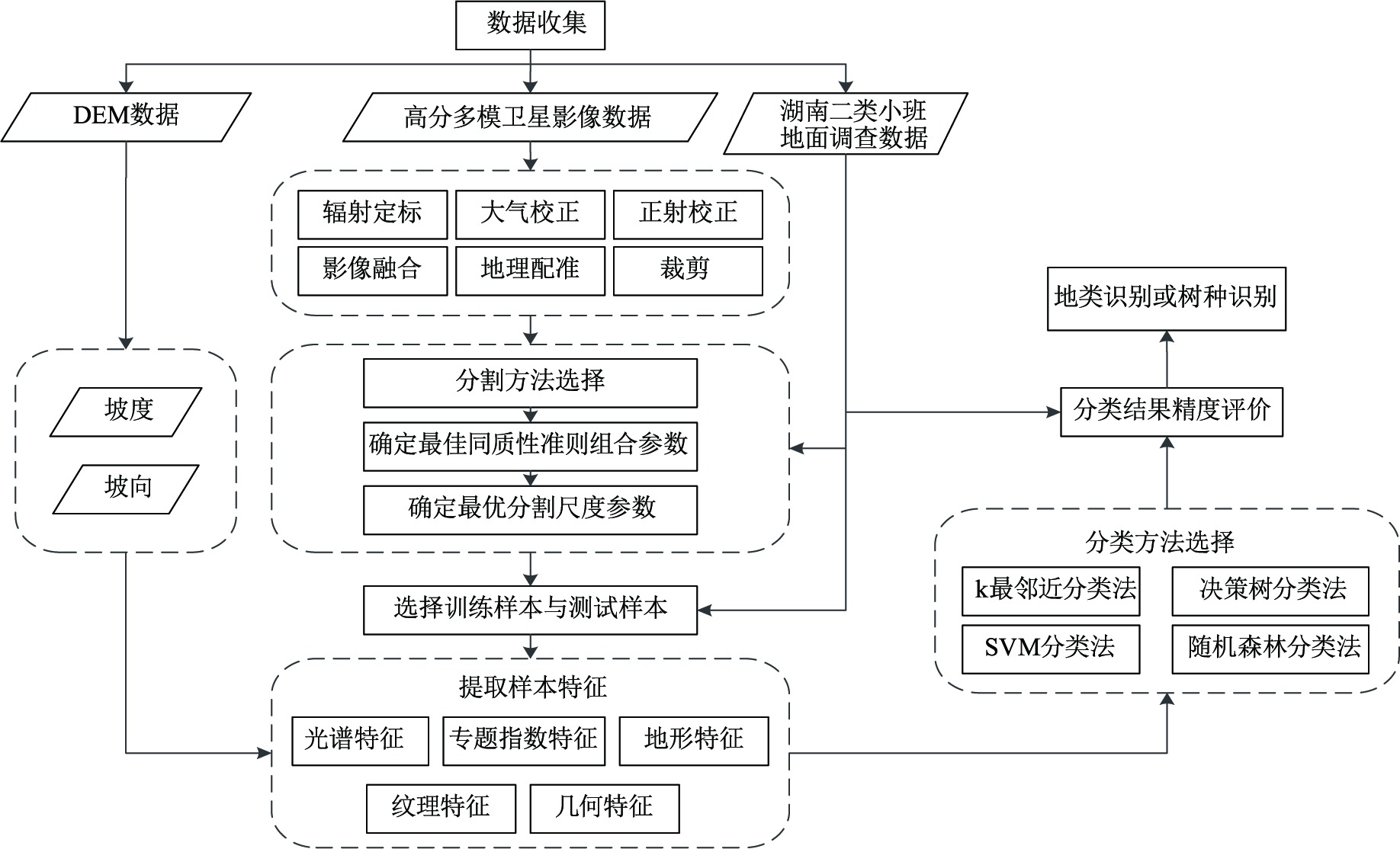
Application of High Resolution Multi-Mode Satellite in Forest Land Types and Tree Species Identification
GAO Jinping1(), YU Huina1, ZHAI Zhaokun2
1. Academy of Forest Inventory and Planning,National Forestry and Grassland Administration,Beijing 100714,China 2. National Geomatics Center of China,Beijing 100830,China
GAO Jinping, YU Huina, ZHAI Zhaokun. Application of High Resolution Multi-Mode Satellite in Forest Land Types and Tree Species Identification[J]. FOREST RESOURCES WANAGEMENT, 2023, 0(1): 127-132.
Meyer D, Leisch F, Hornik K. The support vector machine under test[J]. Neurocomputing, 2003, 55(1-2):169-186.
doi: 10.1016/S0925-2312(03)00431-4
[7]
Priyama A, Guptaa R, Rathee A, et al. Comparative analysis of decision tree classification algorithms[J]. International Journal of Current Engineering and Technology, 2013, 3(2):334-337.
[8]
Pal M. Random forest classifier for remote sensing classification[J]. International Journal of Remote Sensing, 2005, 26(1):217-222.
doi: 10.1080/01431160412331269698
[9]
Craig J C. A confusion matrix for tactually presented letters[J]. Perception & Psychophysics, 1979, 26(5):409-411.
doi: 10.3758/BF03204167
 ), YU Huina1, ZHAI Zhaokun2