欢迎访问林业资源管理

林业资源管理 ›› 2023, Vol. 0 ›› Issue (1): 127-132.doi: 10.13466/j.cnki.lyzygl.2023.01.015

• 技术应用 • 上一篇    下一篇

高分多模卫星林业地类及树种识别应用研究

高金萍1(), 于慧娜1, 翟召坤2   

  1. 1.国家林业和草原局林草调查规划院,北京 100714
    2.国家基础地理信息中心,北京 100830
  • 收稿日期:2022-11-01 修回日期:2022-12-17 出版日期:2023-02-28 发布日期:2023-05-05
  • 作者简介:高金萍(1976-),女,湖北鄂州人,教授级高级工程师,博士,主要从事林业和草原领域信息化应用研究、标准方案编制和信息工程建设工作。Email:gaojinping@qq.com
  • 基金资助:
    高分多模卫星用户数据处理与应用示范研究(BJ2001)

Application of High Resolution Multi-Mode Satellite in Forest Land Types and Tree Species Identification

GAO Jinping1(), YU Huina1, ZHAI Zhaokun2   

  1. 1. Academy of Forest Inventory and Planning,National Forestry and Grassland Administration,Beijing 100714,China
    2. National Geomatics Center of China,Beijing 100830,China
  • Received:2022-11-01 Revised:2022-12-17 Online:2023-02-28 Published:2023-05-05

摘要:

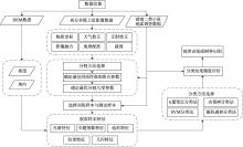
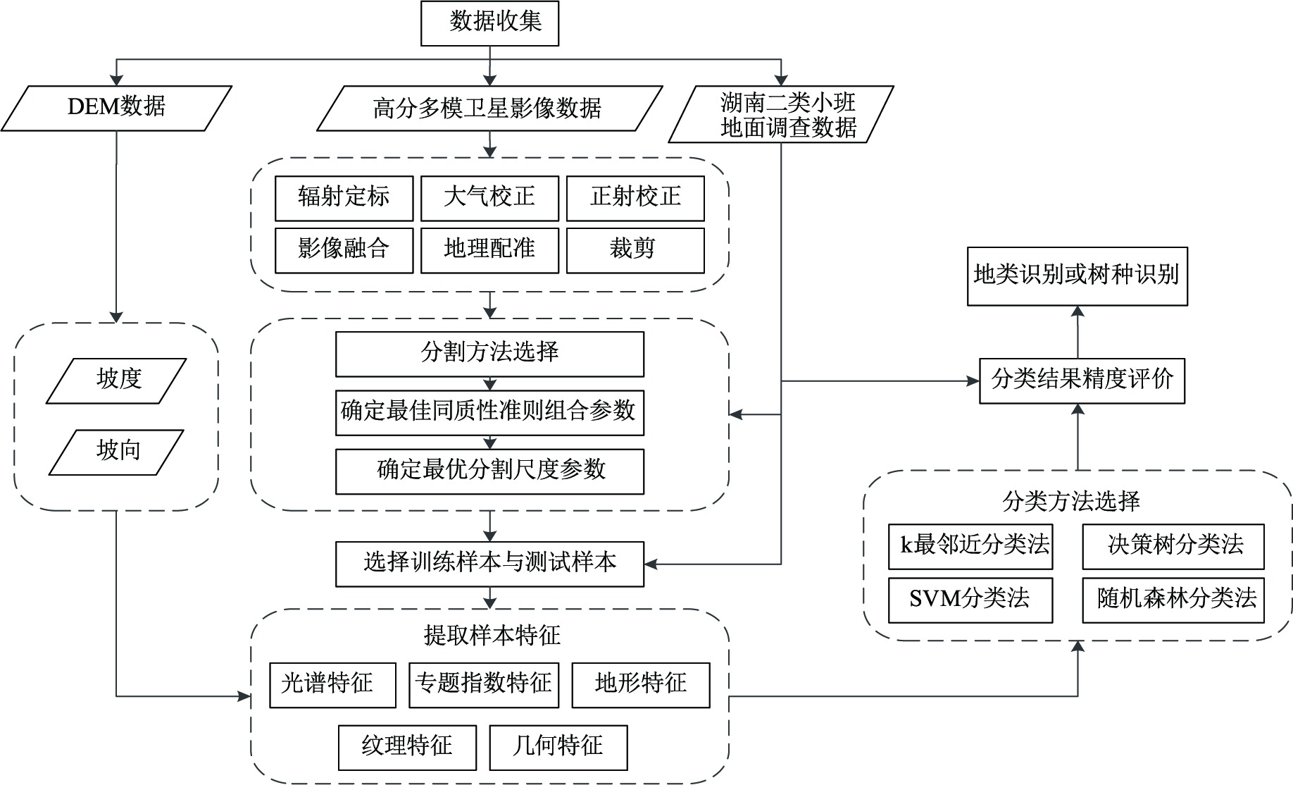
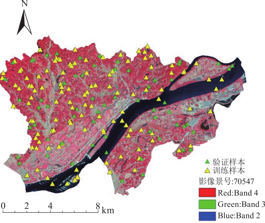
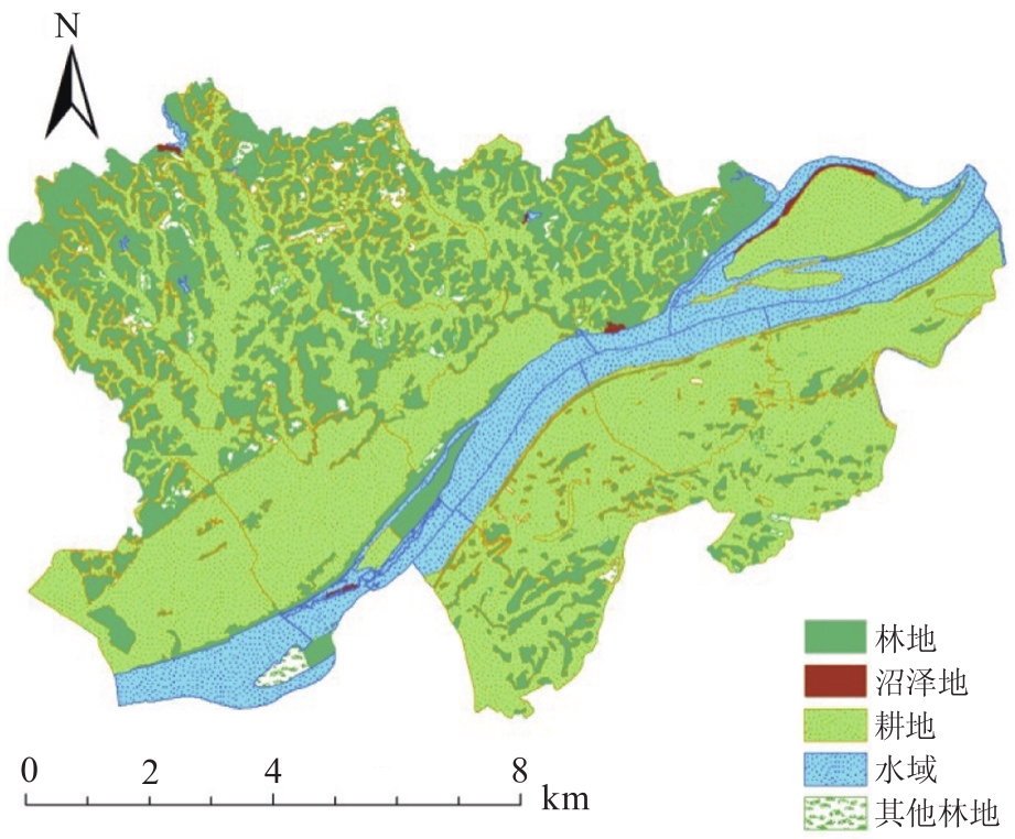
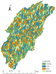
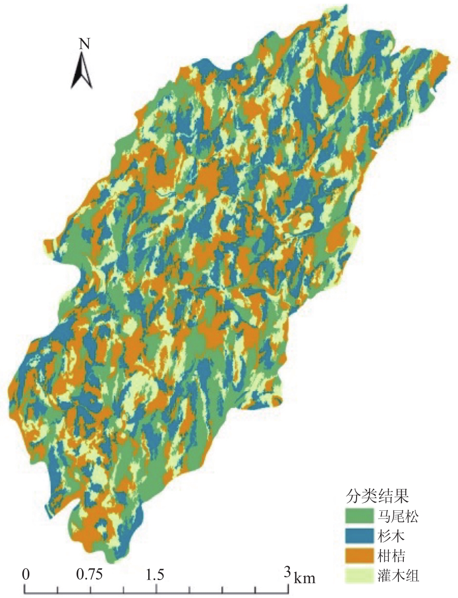
遥感分类技术一直是林草行业应用的热点和难点,2021年开展的国家林草综合生态年度监测开始广泛应用遥感技术开展林地、草地和湿地图斑变化判读,地类前后变化的识别精度是其难点和关键。通过利用国内首颗分辨率优于0.5m的高分多模卫星,在湖南省桃源县、吉首市2个试验区分别开展林业主要地类识别和树种精细识别应用实践研究。结果表明:随机森林方法在林业地类识别中表现较好,林地、湿地、其他林地等主要地类的总体分类精度为89.56%,Kappa系数为0.733;K最邻近分类法对杉木、马尾松、灌木组、柑桔4个主要树种的总体识别精度为77.58%,Kappa系数为0.697。总体而言,高分多模卫星遥感分类和目标识别能力较好,在林草调查监测工作中应用潜力较大。

关键词: 高分多模卫星, 林业地类识别, 树种识别, 随机森林, K最邻近分类法

Abstract:

Remote sensing classification technology has always been the hotspot and difficulty in forest and grassland monitoring.Since 2021,the annual comprehensive ecological monitoring of forest and grassland has been widely applied remote sensing classification technology in the interpretation of patch types and changes of forest land,grassland and wetland.GFDM Satellite is the first civil optical remote sensing satellite with the resolution better than 0.5 meters in our country.In this paper,we used the GFDM satellite data to identify forest land types and tree species in Taoyuan County and Jishou City of Hunan Province.The results showed that the random forest method performed well in the identification of forest land types.The overall classification accuracy of forest land,wetland and other forest land was 89.56%,and the Kappa coefficient was 0.733.The K-nearest neighbor method was used to identify Chinese fir,Masson pine,shrub group and citrus.The overall recognition accuracy of the four main tree species was 77.58%,and the Kappa coefficient was 0.697.In general,GFDM satellite has good ability in remote sensing classification and target recognition,and has great application potential in forest and grassland monitoring.

Key words: high resolution multi-mode satellite, forest land type identification, tree species identification, random forest, K-nearest neighbor

中图分类号: